


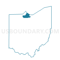
035 HARRIS 3, Ottawa County, Ohio
About
Outline

Summary
| Unique Area Identifier | 650873 |
| Name | 035 HARRIS 3 |
| County | Ottawa County |
| State | Ohio |
| Area (square miles) | 13.58 |
| Land Area (square miles) | 13.53 |
| Water Area (square miles) | 0.05 |
| % of Land Area | 99.62 |
| % of Water Area | 0.38 |
| Latitude of the Internal Point | 41.49985310 |
| Longtitude of the Internal Point | -83.26990830 |
Maps


Graphs
Select a template below for downloading or customizing gragh for 035 HARRIS 3, Ottawa County, Ohio


Neighbors
Neighoring Voting District (by Name) Neighboring Voting District on the Map
- 015 BENTON 2, Ottawa County, OH
- 016 BENTON 3, Ottawa County, OH
- 025 CLAY 3, Ottawa County, OH
- 033 HARRIS 1, Ottawa County, OH
- 034 HARRIS 2, Ottawa County, OH
- 036 HARRIS 4, Ottawa County, OH
- 046 SALEM 4, Ottawa County, OH
- 047 SALEM 5, Ottawa County, OH
- Voting District WOOD TWP, Sandusky County, OH
Top 10 Neighboring County Subdivision (by Population) Neighboring County Subdivision on the Map
- Salem township, Ottawa County, OH (5,371)
- Clay township, Ottawa County, OH (5,058)
- Woodville township, Sandusky County, OH (3,395)
- Harris township, Ottawa County, OH (3,018)
- Benton township, Ottawa County, OH (2,641)
Top 10 Neighboring Place (by Population) Neighboring Place on the Map
Top 10 Neighboring Unified School District (by Population) Neighboring Unified School District on the Map
Top 10 Neighboring State Legislative District Lower Chamber (by Population) Neighboring State Legislative District Lower Chamber on the Map
Top 10 Neighboring State Legislative District Upper Chamber (by Population) Neighboring State Legislative District Upper Chamber on the Map
Top 10 Neighboring 111th Congressional District (by Population) Neighboring 111th Congressional District on the Map
Top 10 Neighboring Census Tract (by Population) Neighboring Census Tract on the Map
- Census Tract 509, Ottawa County, OH (5,659)
- Census Tract 510, Ottawa County, OH (5,058)
- Census Tract 9610, Sandusky County, OH (4,213)
- Census Tract 508, Ottawa County, OH (4,056)